
Description
DJI Mavic 3T Fly More Combo – Dual Camera Thermal Drone with 4K Video & Long Flight Time
When you’re ready to buy drones online, the DJI Mavic 3T Fly More Combo stands as one of the most capable, reliable, and versatile aerial platforms available today. It combines DJI’s high-end thermal imaging technology with the legendary Hasselblad 4K camera system—all packed into a compact, foldable frame designed for professionals.
Whether you’re in the USA or Canada searching for DJI drone deals, camera drones, or a professional drone for mapping, inspection, or emergency response, the Mavic 3T delivers industry-leading performance with complete confidence. Every combo includes a 2-year warranty and a full accessory kit to keep your operation running.
Why Buy the DJI Mavic 3T Fly More Combo?
The DJI Mavic 3T is not your average consumer drone. This version is built for serious users—engineers, firefighters, inspectors, filmmakers, and commercial drone operators who need thermal insight alongside crystal-clear daytime footage. With up to 45 minutes of uninterrupted flight time, the Mavic 3T can scan large areas in a single session.
Key advantages:
Dual imaging with radiometric thermal sensor + Hasselblad 4K camera
56× zoom and split-screen thermal + visual comparison
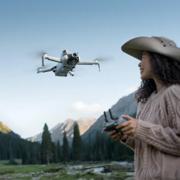
DJI RC Pro Enterprise remote controller with built-in screen
Obstacle detection from all directions with omnidirectional sensors
Advanced autonomous flight planning tools and mission replay
Mavic 3T Camera and Imaging Features
The core strength of this combo lies in its integrated imaging system. You’re not mounting separate payloads—you’re getting both views, simultaneously, in one flight.
1. Thermal Camera
640×512 resolution
30Hz frame rate
Temperature range: -20°C to +150°C (expandable to +550°C)
Isotherms, area measurement, and high-temperature alerts
Ideal for:
Fire departments identifying hotspots
Power companies inspecting solar panels
Structural engineers reviewing insulation
Search and rescue teams locating heat signatures
2. Visual Cameras
20MP 4/3 CMOS wide-angle Hasselblad camera for cinematic clarity
12MP telephoto camera with up to 56× hybrid zoom
Capture in 4K at 30 fps
ND filters included for bright conditions
Both cameras support side-by-side viewing or overlay for precision analysis.
Flight Time, Range & Control
Aerial coverage is critical for professionals. That’s why this combo includes two flight batteries that each offer up to 45 minutes of flight time, alongside a 100W charging hub for quick top-offs between missions.
Control & Transmission
OcuSync Enterprise transmission with a 15 km video feed range
DJI RC Pro Enterprise with a bright 5.5″ display—no smartphone needed
Omnidirectional obstacle avoidance with APAS 5.0
No matter the complexity of your environment—urban, forested, or industrial—the Mavic 3T maintains stability and connectivity.
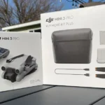
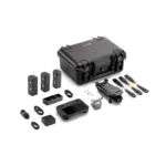
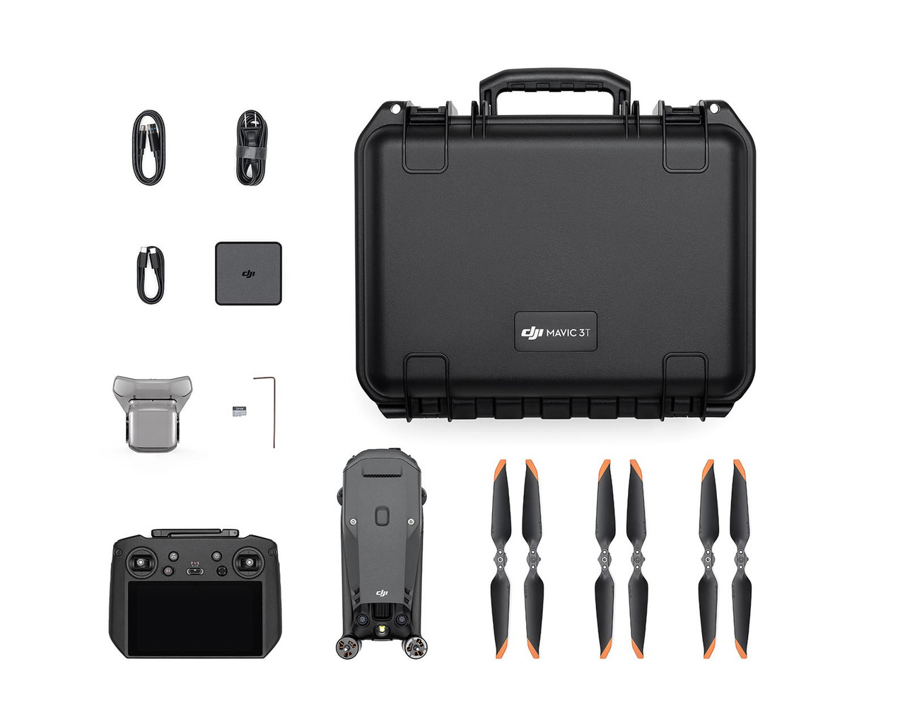
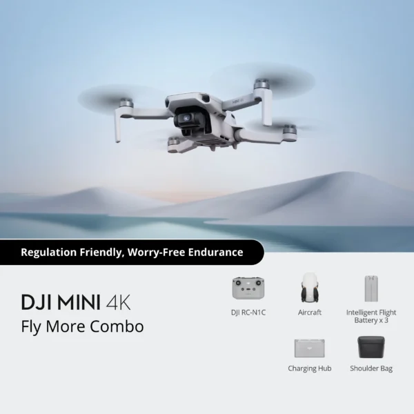
What’s Included – Fly More Combo Kit
Everything you need to launch and operate in the field:
DJI Mavic 3T drone
DJI RC Pro Enterprise controller
2 intelligent flight batteries
6 pairs of propellers
ND Filter Set (ND8/16/32)
100W charging hub + cables
Shoulder carry case
64GB microSD card
Gimbal protector, screwdriver, accessory kit
Warranty, Returns & Support
We are an authorized DJI drone retailer in the USA and Canada. Your purchase includes:
2-Year DJI Manufacturer Warranty
30-Day Return Policy if the drone arrives damaged or defective
Free shipping and local support
Drone repair and accessory replacement services available
You can buy DJI drones online confidently knowing you’re supported by experts.
Use Cases for DJI Mavic 3T
This drone is trusted across industries. Applications include:
Public Safety: Find missing persons with thermal imagery
Utility Inspection: Monitor electrical lines, pipelines, or HVAC systems
Surveying & Mapping: Collect geospatial data with accurate flight planning
Roof Inspections: Detect leaks, poor insulation, and weather damage
Wildlife & Agriculture: Monitor livestock, wildlife, or crop health remotely
The DJI Mavic 3T Fly More Combo isn’t just hardware—it’s a complete aerial intelligence system built for productivity, precision, and decision-making. When used alongside DJI’s ecosystem of enterprise-grade software tools, it becomes an end-to-end solution for mapping, data collection, infrastructure inspection, and emergency response.
DJI Software Suite – Transforming Data Into Insight
Professionals who fly drones aren’t just flying to capture nice images—they need actionable, measurable data. That’s where the DJI Mavic 3T thrives, thanks to a deeply integrated software ecosystem optimized for planning, executing, and analyzing flights.
1. DJI Pilot 2 – Enterprise Flight Interface
The Mavic 3T is fully compatible with DJI Pilot 2, a streamlined, smart flight interface designed specifically for professional operators. With Pilot 2, you can:
Pre-plan missions with waypoints, mapping grids, or corridor scans
View live split-screen of visual and thermal feeds simultaneously
Access advanced settings like obstacle avoidance sensitivity, custom geofencing, and intelligent return-to-home
Whether you’re inspecting pipelines or scanning a disaster site, Pilot 2 enables precise navigation and data capture with full situational awareness.
2. DJI FlightHub 2 – Real-Time Team Collaboration in the Cloud
FlightHub 2 is DJI’s mission control platform for teams. It allows users to remotely:
Monitor live drone telemetry and feeds from multiple units
Share locations, tag map points, and coordinate movements in real time
Manage drone fleets and operators across multiple sites
Perfect for police, search and rescue, or enterprise teams operating across large areas or disaster zones.
3. DJI Terra – 2D & 3D Mapping and Modeling
When it comes to mapping, DJI Terra is the go-to solution. Use your Mavic 3T with Terra to create:
2D orthomosaic maps
3D terrain models
Thermal analysis overlays
Surveyors and engineers can use this data for elevation modeling, construction planning, infrastructure review, and inspection workflows. It even integrates with third-party GIS and CAD tools.
Real-World Industry Applications – Where Mavic 3T Earns Its Value
The Mavic 3T Fly More Combo is more than a luxury tool—it’s a necessity in high-stakes fields. Here are just a few of the most powerful, proven applications:
🔧 Infrastructure Inspection
Utility companies, telecom providers, and infrastructure engineers rely on the Mavic 3T to inspect:
Power lines and towers
Cellular and radio towers
Bridges and overpasses
Industrial rooftops, HVAC units, and solar arrays
Use the 56× hybrid zoom to inspect small components at a safe distance. Detect temperature abnormalities or damaged materials through thermal scanning, all without stopping operations or risking human crews.
🚨 Public Safety & Search and Rescue
Time matters during search and rescue or disaster response. The thermal sensor can locate missing persons in remote areas or smoke-obstructed zones. The RC Pro Enterprise controller enables full real-time video sharing with command centers via FlightHub.
Key benefits:
Quick area scanning via thermal
Geotagging to report precise locations
4K video documentation for legal or investigative use
🏗️ Construction & Site Monitoring
Builders and contractors can use the Mavic 3T to track progress, inspect work safely, and create thermal overlays for roof and insulation evaluations. With DJI Terra, they can generate full-site maps in a matter of hours.
🌾 Agriculture & Environmental Monitoring
Monitor plant health with thermal overlays. Survey crops for irrigation issues, or track wildlife and livestock over large areas. The Mavic 3T allows consistent flights with GPS-tagged images for time-based comparisons.
📷 Media Production and Documentaries
With the included ND filters and Hasselblad camera, the Mavic 3T captures cinematic video and rich 20MP photos—even in tough lighting. Media producers can incorporate both visual and thermal storytelling, ideal for documentaries or environmental journalism.
DJI Mavic 3T vs. Other Drones – Why It Wins
Compared to lower-tier camera drones or older enterprise models, the Mavic 3T delivers unique advantages:
| Feature | DJI Mavic 3T Fly More Combo | DJI Mavic Air 2S | DJI Matrice 30T |
|---|---|---|---|
| Thermal Imaging | ✅ Radiometric 640×512 | ❌ | ✅ Higher-end 640×512 |
| Flight Time | ✅ 45 minutes | ✅ 31 minutes | ✅ 41 minutes |
| Zoom Capability | ✅ 56× Hybrid Zoom | ✅ 4× Digital Zoom | ✅ 200× Hybrid Zoom |
| Portability | ✅ Foldable, ultra-light | ✅ Foldable | ❌ Larger/heavier |
| Software Compatibility | ✅ Pilot 2, FlightHub, Terra | ❌ (consumer-focused) | ✅ Enterprise full stack |
| Price Point | 💰 Mid-range | 💰 Low-mid | 💰💰 High |
The Bottom Line: Built for Performance, Priced for Professionals
The DJI Mavic 3T Fly More Combo hits the perfect balance of power, portability, and performance—without the oversized price tag of industrial drones. For under half the price of a Matrice 30T, you gain access to:
Dual imaging technology
Extended flight time
Real-time cloud connectivity
DJI’s leading enterprise software suite
Foldable, field-ready design
Buy DGI Drone –
SHOP FROM THE BEST DRONE STORE ONLINE